
OR
Over exploitation of natural resources endangers watershed in Jumla
Published On: March 24, 2024 08:35 AM NPT By: RSS
JUMLA, March 24: Overexploitation of natural resources has put the watershed zone of Jumla at high risk. Haphazard construction of roads and the extraction of sand and gravel from the river by the local level has had a negative impact on the watershed area.
Considering the situation, the Land and Watershed Management Office in the district held a discussion with local political parties, media persons and stakeholders along with local level heads and deputy heads, and administrative officers in the district about the protection of watersheds and sub-watershed areas.
The discussion program was organized with all stakeholders in the district to collect suggestions of the local government in the next year's policy and program to be brought by the provincial government.
The Land and Watershed Management Office has also asked all the eight local levels in the district for their feedback for the new financial year's watershed and subwatershed annual program, said Himalaya Saud, the head of the office.
On the occasion, Chairperson of Sinja Rural Municipality Purna Prasad Dhital said that the local level will work in cooperation with the watershed management office to preserve the watershed area. He emphasized that necessary technical support should be provided after identifying the high risk and low risk areas of the district.
Likewise, Tatopani Rural Municipality Chair Nanda Prasad Dhital said that the office needs to pay attention in selection of projects as per the requirement of the respective local level.
Head of the District Coordination Committee, Gaurinanda Acharya, said that the role of the local level in protecting the river and environment is important. Acharya said that the political parties of the district have suggested to all the three governments to work with the direct participation of the people.
Chief Administrative Officer of Tila Rural Municipality Tek Bahadur Thapa said that the local level has also allocated funds for the watershed program. But there is a need for coordination between the local level and the watershed office to implement the plan.
You May Like This
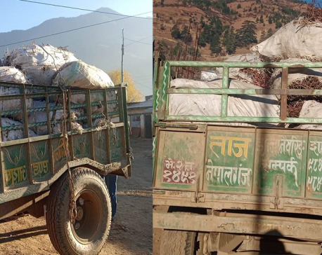
Tractor carrying herbs under police control
JUMLA, Dec 5: The District Police Office, Jumla, has seized a tractor carrying herbs. The tractor (Bhe 2 Ta 1491),... Read More...

Black frost destroys apples in Jumla
JUMLA, June 26: Dhanlaxmi Khatri of Gothichaur-4 had produced nearly eight quintals of apples from 220 trees last year. But this... Read More...

Organic onions of Jumla fail to get buyers
JUMLA, Sept 12: Basanti Devkota of Chandannath-1 in Jumla has a new job these days -- take onions out in the... Read More...

Just In
- Nepal and Vietnam could collaborate in promotion of agriculture and tourism business: DPM Shrestha
- Govt urges entrepreneurs to invest in IT sector to reap maximum benefits
- Chinese company Xiamen investing Rs 3 billion in assembling plant of electric vehicles in Nepal
- NEPSE inches up 0.07 points, while daily turnover inclines to Rs 2.95 billion
- Gandaki Province reports cases of forest fire at 467 locations
- Home ministry introduces online pass system to enter Singha Durbar
- MoLESS launches ‘Shramadhan Call Center’ to promptly address labor and employment issues
- Biratnagar High Court orders Krishna Das Giri to appear before court within one month in disciple rape case







Leave A Comment