
OR
Nepal’s cabinet makes historic decision, to publicize Nepal’s map including Kalapani and Limpiyadhura
Published On: May 19, 2020 08:45 AM NPT By: Republica | @RepublicaNepal
_20200519093822.jpg)
KATHMANDU, May 19: The government has endorsed a new political map that includes Kalapani and Limpiyadhura. The government will soon publicize the new political map that incorporates the territory unilaterally kept by India on its side of the border.
A cabinet meeting held at the official residence of the Prime Minister in Baluwatar on Monday took a decision to this effect. Minister for Land Management Padma Aryal had presented a proposal of a new political map of the country at the cabinet meeting for endorsement.
Minister for Culture, Tourism and Civil Aviation, Yogesh Bhattarai said the decision of the cabinet on Monday will be written in golden letters. While stating that the date and decision of the cabinet on Monday will be asked in all quiz contests for ages to come, Minister Bhattarai in his tweet after the cabinet meeting also thanked Prime Minister KP Oli for taking the decision. Minister Aryal had earlier said that a new political map had already been prepared as per the directive of a parliamentary committee.
India and Nepal are at odds after the Indian side issued a new political map incorporating Kalapani and Lipu Lekh on its side of the border in October last year. The tension between the two countries flared up lately after the Indian side inaugurated a link road that passes through the territory belonging to Nepal.
You May Like This
Issue new map comprising Indian-encroached areas: House panel
KATHMANDU, Dec 14: The International Relations Committee of the parliament has directed the government to issue a new political map... Read More...

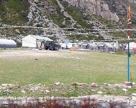
Chiefs of Nepal Army, Armed Police Force visit border outpost near Kalapani
KATHMANDU, June 17: Chief of the Army Staff (CoAS) Purna Chandra Thapa and Inspector General (IG) of Armed Police Force... Read More...

US commits additional $1.8 million to Nepal to combat COVID-19
KATHMANDU, March 20: The US government has announced an additional $1.8 million in assistance to bolster the Government of Nepal’s... Read More...


Just In
- Kushal Dixit selected for London Marathon
- Nepal faces Hong Kong today for ACC Emerging Teams Asia Cup
- 286 new industries registered in Nepal in first nine months of current FY, attracting Rs 165 billion investment
- UML's National Convention Representatives Council meeting today
- Gandaki Province CM assigns ministerial portfolios to Hari Bahadur Chuman and Deepak Manange
- 352 climbers obtain permits to ascend Mount Everest this season
- 16 candidates shortlisted for CEO position at Nepal Tourism Board
- WB to take financial management lead for proposed Upper Arun Project


_20220508065243.jpg)



Leave A Comment