
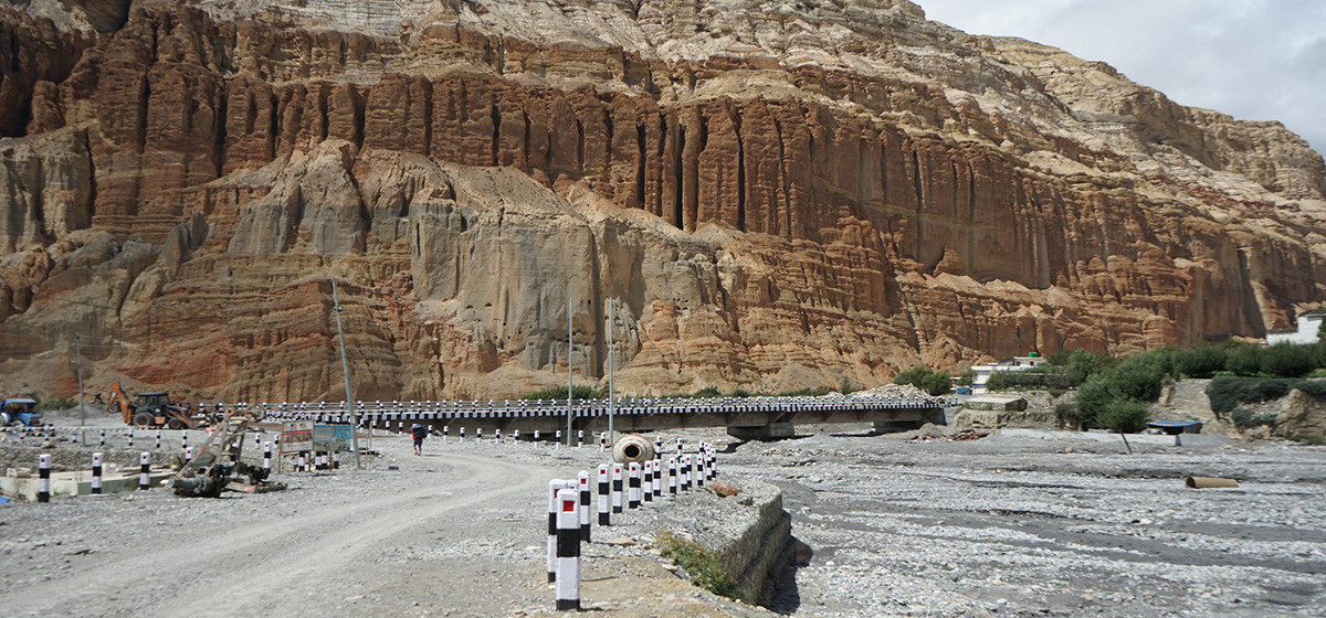
Construction of the 42 km track that began on May 18, 2013 has cost Rs 416.4 million, according to Colonel Resmi Raj Bhattarai, chief of NA construction taskforce in the district. "We have been working on Maldunga-Takure section in Baglung as well," he informed.
"Additionally, decision has been taken to construct road from Palung Khola to Takare of Baglung. It is just awaiting budget allocation, which may cost about Rs 330 million," added Bhattarai. The NA has so far spent Rs 566.4 million in the project.
The government had allotted the project to the NA as it seemed to be impossible to bring down rocks and hills along the Kaligandaki corridor without the army's expertise. The NA has been using explosives to blast hard rocks in the area. It cost Rs 58 million for the army to blast a seemingly impregnable cliff in Gulmi alone to open the track.
According to the NA, the army's unit had to toil hard to open the track at Bakewa cliff, Bargare cliff, Thapani cliff, Latre cliff, Bagdikhola cliff, Mauri cliff along with many others places in the 42-kilometer section.
The total length of the corridor is 369 km and the proposed highway connects Gaidakot of Nawalparasi district in the south to Palpa, Gulmi, Baglung, Myagdi, Mustang in the north. The highway also links China and India.
Tika Ram Dhakal, spokesperson of Central Stakeholder Committee of the Kaligandaki Corridor claimed that the road section in Gulmi, which covers 42 km, will be the shortest and easiest road linking China and India.
Apart from 22 km section of Palung Khola to Takare of Baglung, all other tracks of the Kaligandaki Corridor project have been opened.
Related story
Revised interest rate corridor system introduced


-1782125987.webp)
-1200x560-1782120651.webp)


