Friday, 19 April 2024 05:00 PM
OR
Login using
Thursday Talk
Doklam dispute should make us serious about protecting our land at tri-junctions
Published On: July 20, 2017 03:30 PM NPT By: Mahabir Paudyal | @mahabirpaudyal

Cartographer and scholar on border issues Buddhi Narayan Shrestha brings with him 27 years of experience working in the government’s Department of Survey and 21 years of experience in private land-surveying. Republica’s Mahabir Paudyal caught up with the veteran expert on Nepal’s borders to get his views on the current standoff over Doklam tri-junction between India, China and Bhutan. Are there similar tri-junctions between India, China and Nepal? If yes, how can Nepal forestall a Doklam-like situation?
How do you as a border expert see the current standoff between India and China over Doklam?
The conflict surfaced after China started building a road connecting Yadong with Sigatse, both in Tibet. India reacted, saying that the road passed through Bhutanese territory and sent its troops to stop construction. China retaliated by saying that since it was constructing road within its own territory, there was no need for India to be concerned. This led to a war of words between India and China. Chinese troops then entered the scene and destroyed two Indian bunkers. While this is one cause of China-India standoff, it also is related with impending boundary issues between China and Bhutan. The conflict is concentrated 20 kilometer northeast of the tri-junction between India, Bhutan and China.
In your view who is in the wrong, India or China?
The answer is obvious. India thinks of Bhutan as its protectorate. India looks after defense and foreign affairs of Bhutan. Since the issue is related with border and thereby border security, India intervened. But in the event of a dispute, it should have been between Bhutanese and Chinese troops. Interestingly, however, both Indian and Chinese troops have refrained from using arms. They do not use even hands to ward off each other. They push away opponent soldiers using their chests. This conflict is thus unlikely to escalate into an armed war. This looks more like a prestige issue for both India and China. India wants to prove to the world that it is superior to China. And China wants to show that it is second only to the US in terms of economic, military and political powers.
Could you tell us a little bit about the Doklam region and why it is a contested area?
The Anglo-China Convention of 1890 had agreed to follow the ‘watershed principle’ while demarcating the boundary between Bhutan and China. They agreed to make the highest line of the mountains boundary markers. Borders were demarcated based on this convention in 1895 and a 220 kilometer-long-boundary line was drawn. But later disputes emerged over this territory. Then in 1998 Bhutan and China signed an agreement whereby the two countries agreed to maintain the status quo. China is building road over the land the two countries had agreed to leave as status quo. India claims that even that ‘status quo’ land belongs to Bhutan and China has no business occupying Bhutanese land. China is now building road on no-man’s land within Chinese territory of Doklam region. Bhutan has reacted to Indo-China conflict most diplomatically, saying that the areas agreed to as status quo should remain status quo. Indirectly, Bhutan seems to be telling China: let us not fight over this issue.
But what does international law say?
Laws and principles on international borders are based on whether the countries to border dispute have border treaty and whether they have abided by provisions of those treaties. In terms of the border disputes between Bhutan and China, there have been two agreements, one in 1892 and another in 1998. The dispute now is not over whether China has built roads in Bhutanese territory but why did it build on no man’s land.
Indian stand on this issue would perhaps be justified if it also refrained from building roads on no man’s land. India itself has built a road along its no man’s with Nepal, on the stretch between Ilam district’s Mane Bhanjyang and Pashupati Nagar. The road passes close to Junge pillars. So what India opposes in Doklam, it has been doing vis-à-vis Nepal. Nepal can raise this issue with India by citing international laws on borders.
What is the significance of ‘no man’s land’ in international borders?
According to principles of international borders, no man’s land does not fall under sovereignty of either bordering country. It is a sensitive space, so much so that if a person makes it a hideout after committing a serious crime in one country, security forces of that country cannot take him under control. If they do, it will contravene international principles. The idea is when a person from one country commits a crime and hides in no-man’s land, he won’t be able to survive there for long and he will enter the territory of either country, in which case he will be apprehended.
Do we in Nepal have a sensitive tri-junction point like Doklam?
We have two such tri-junctions in Nepal. One lies in Kalapani-Limpiyadhura-Lipu Lekh area, which we have already lost. India and China fought a war in 1962 after a dispute erupted when India asked China to honor the McMahon line drawn by Sir Henry McMahon in 1914. Neither Tibet nor China had agreed to this line because they said it had been drawn ‘arbitrarily’ by British India. When Tibet became part of China, China raised this issue with India many times. India insisted that China should follow McMahon line and China rejected the proposition outright. The dispute escalated into a full-fledged war in 1962 and Chinese troops pushed Indian troops far beyond the McMahon line. The Chinese advanced up to the area which they considered Chinese territories and stopped there. Indian troops then started looking for a safe spot to check possible Chinese incursions in the future. They found this spot in Kalapani, where they set up a camp and where they are based even today. We lost this tri-junction to India because of war between India and China. This is one glaring example of how Nepal suffers when India and China fight.
Another such tri-junction lies in Jhinsang Chuli of Taplejung district. Nepal, India and China meet in this strategic point. So there should be a tri-junction marker there. But there isn’t. This is because when China-Nepal borders were being settled in 1961/62, border boundary pillar number 79 was erected 14 kilometers from the tri-junction point, inside Nepali territory.
All three countries which share tri-junction should agree to demarcate the tri-junction point. Nepal had written to India to send its representative for this purpose but India refused perhaps because it had only just emerged from the war with China. The tri-junction point could not be demarcated in Kalapani-Lipu Lekh either because of the same reason.
Could we also lose Jhinsang Chuli tri-junction just like we lost Lipu Lekh?
Perhaps. Jhinsang Chuli is just 150 kilometers west (sky distance) from Doklam. Since there is no tri-junction pillar and since our border pillar (79) has been erected 14 kilometers west from the border, if one day India and China agree on some infrastructure project there, we might lose this part of our territory as well. So, yes, we might lose Jhinsang Chuli the way we lost Lipu Lekh.
Lipu Lekh is sensitive in terms of security, trade and transit but Jhinsang Chuli is not such a sensitive strategic point as it’s a snowy region. But so was Doklam. It is a ridgeline, not a transit point, nor is there human habitation. Who would have thought Doklam could be a bone of contention? We cannot rule out the possibility of tri-junction trouble in Jhinsang Chuli as well. What has happened in Doklam today could happen in Jhinsang Chuli of Taplejung.
Tension may arise between India and China over Lipu Lekh as well because this is also a tri-junction. What if Chinese troops come to Lipu Lekh from Taklakot and Indian troops of Kalapani proceed to Lipu Lekh. The ensuing battle could displace the remaining Nepali people living around Kalapani. Doklam dispute should make us serious
about protecting our land at tri-junctions.
You talked about Nepal’s raw deal on Kalapani. Nepal had removed Indian military missions from its northern areas in the late 1960s. So why couldn’t we also remove Indian military from Kalapani?
There were 18 Indian check posts, including in Humla, Gorkha, Solukhumbu, Taplejung and many other northern border points. These check posts were set up while Matrika Prasad Koirala was the prime minister in 1953. It was only in 1968, when Kirti Nidhi Bista became the prime minister, that these check posts were removed. There are conflicting accounts of why Nepal did not remove Indian troops from Kalapani.
It was reported in one weekly that Rishikesh Shah, who was foreign minister at the time, asked King Mahendra why Nepal had not removed Indian troops from Kalapani. The king was reported as saying: ‘Let them be, I have offended India enough’. After around three weeks of this report, Sailendra Kumar Upadhyay denied that the king said anything of the kind. He rubbished Rishikesh Shah’s statement. So why Nepal could not remove Indian troops from Kalapani in the 1960s remains a mystery.
We have longstanding border disputes with India. Why have those disputes not been resolved?
There have been prolonged border disputes over Kalapani and Susta. In Kalapani (Limpiyadhura, Kalapnai, Lipulekh), 370 square kilometers of land are disputed. In Susta, 145 square kilometers are in dispute. These are the two biggest disputes. The disputes have lingered because India does not agree to the border maps presented by Nepal. And India often presents a map that is unacceptable to Nepal. Nepal says the 1853 border strip map, which shows Kalapani area within Nepal, should be considered authentic. But these are the territories India is occupying and so it refuses to recognize even the authentic map. India once brought up a map from 1857 which shows Kalapani, Lipu Lekh and Limpiyadhura as falling within India. Nepal cannot agree to this. This is why disputes remain.
From what you said, Nepal has been steadily losing its territories, from Kalapani to Susta. What can we do to secure our lands from foreign encroachment?
We don’t take border encroachment seriously. But it’s a grave issue. If, say, a square kilometer of our land has been encroached, people living there are either displaced or become foreigners in their own land. They lose their habitat as well as their Nepali identity. When India occupied Kalapani, Nepalis living in villages like Nabahi, Dang, Gunji, Tulsi Nyurang and Kuti were displaced. They were forced to leave behind their lands and homes.
Every inch of our territory is important. If slowly more and more areas of Nepal are encroached, great many Nepalis will be foreigners in their own land. Nepal’s size will shrink and its very existence may come under threat. This is why Nepal should take its borders seriously. The joint technical team of India and Nepal should sit together and set up all the proposed 8,553 border pillars. So far only 4,200 pillars have been erected. Of these around 1,700 pillars have either been flattened, buried or even uprooted. In some places there are no border pillars at all. When there are no border pillars, our land becomes highly susceptible to encroachment. So the first thing Nepal should do is to set up those pillars in consultations with India. Of 147,181 square kilometers of Nepali lands, 606 square kilometers are either disputed, or encroached upon or already lost. Nepal must flex its diplomatic muscles to bring them back. Besides, we need to make proper arrangements for border security. India has deployed 45,000 border security personnel along the border with Nepal. But Nepal only has 5,600 Armed Police Force personnel patrolling border areas. This shows how we take border security for granted.
Protecting its territory has been one key challenge for Nepali state historically. How should Nepal go ahead in the days to come?
We need to learn from history. We have lost our lands both when India and China are on friendly terms and when they are in discord. When India and China fought in 1962 we were shortchanged over Kalapani. When they stood together in 2015, they bypassed Nepal while signing the Lipu Lekh deal. When they were on good terms India recognized Tibet as Chinese territory and China recognized Sikkim’s merger into India. Now that they are not on good terms they are fighting over territory that does not even belong to either of them.
This is why Nepal must deal with India and China extremely carefully. This is the right time for Nepal to put these concerns to China. The Chinese are very happy to make Nepal a part of the OBOR framework. Nepal should now ask China to extend the rail network to Kathmandu, Pokhara and Lumbini. It should ask China to immediately open Tatopani border. It should also ask China to open the border points in Korala, Hilsa, Kimathanka and Olanghcungola so as to facilitate trade between the two countries.
But on Doklam, Nepal should stay neutral. We need to learn from Nepal’s handling of the issue in 1962. Nepal had supported neither India nor China. Nor had it opposed any one. Nepal should do the same now.
You May Like This
13 PROJECTS SHOW OUR PROMISED LAND
Our pathway to prosperity clearly demands solid investments in infrastructure and in identifying key drivers of growth like the potential... Read More...

Chitwan CDO uninformed about NOC land deal
CHITWAN, Aug 30: A parliamentary committee which is investigating Nepal Oil Corporation (NOC) for its alleged misappropriation of funds on land... Read More...
Locals accuse land mafias of encroaching public land on river banks
JANAKPUR, July 14: Land mafias have illegally erected a wall by encroaching the banks of Basai River in Mithila Municipality in... Read More...


_20240311121839.jpg)

Just In
- In Pictures: Families of Nepalis in Russian Army begin hunger strike
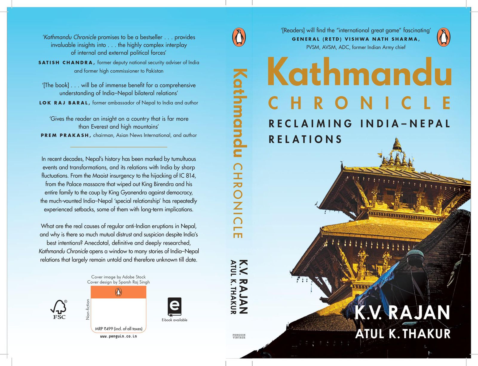
- New book by Ambassador K V Rajan and Atul K Thakur explores complexities of India-Nepal relations
- Health ministry warns of taking action against individuals circulating misleading advertisements about health insurance
- UAE secures spot in ACC Premier Cup final, defeating Nepal by six wickets
- NC to boycott Gandaki Province Assembly, submits letter to Speaker
- 850 grams of gold seized from Indian national at TIA
- Rupandehi District Court orders to release Dipesh Pun on a bail of Rs 400,000
- Teachers’ union challenges Education Minister Shrestha's policy on political affiliation
Leave A Comment