Tuesday, 23 April 2024 01:58 PM
OR
Login using
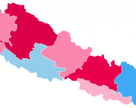
Students unable to learn about Nepal's new political map
September 14, 2023 17:46 pm
KATHMANDU, Sept 14: Three years ago, following parliament's approval of Nepal's new political map, the Survey Department measured the territory according to the updated map and sent the file to the ministry on October 21, 2022. However, as of now, the file remains stalled in the planning division of the ministry. During the time this file was pending in the ministry, the Curriculum Development Center published a book intended for school-level instruction, which included an area of 460.28 square kilometers, encompassing Kalapani, Lipulekh, and Limpiyadhura.
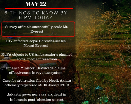
May 22: 6 things to know by 6 PM today
May 22, 2019 18:00 pm
Your daily dose of missed important news of the day.
Trending


Just In
- Gold price drops by Rs 2,700 per tola
- Seven houses destroyed in fire, property worth Rs 5.4 million gutted
- Police pistol missing after drug operation in Bara, investigation underway
- Truck carrying chemical used in drugs catches fire
- Nepali journalists Sedhai and Kharel awarded second prize at Fetisov Journalism Awards for their exposé on worker exploitation in Qatar World Cup
- Devotees gather at Balaju Park for traditional ritual shower at Baisdhara (Photo Feature)
- PPMO blacklists 33 construction companies
- UK Parliament approves Rwanda deportation bill, ending weeks of legislative stalemate