Thursday, 25 April 2024 12:31 PM
OR
Login using
Civil society members unveil new political map of Nepal comprising Limpiadhura, Lipulekh and Kalapani
Published On: November 24, 2019 11:00 PM NPT By: Republica | @RepublicaNepal
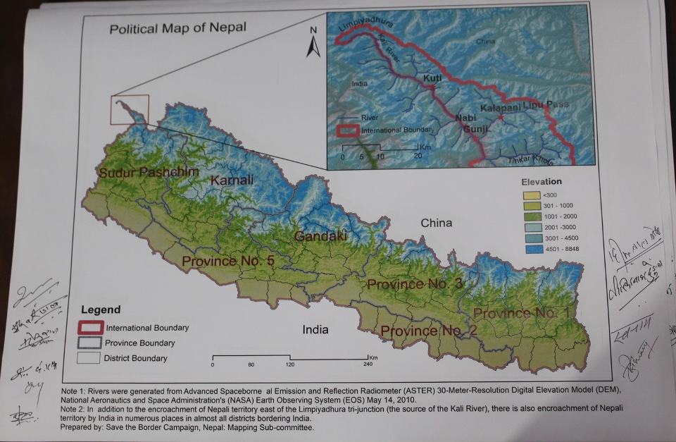
KATHMANDU, Nov 24: Civil society members on Sunday unveiled a new political map of Nepal comprising Limpiadhura, Lipulekh and Kalapani in a bid to exert pressure on the government to issue a fresh political map placing these territories inside Nepali borders.
At a press conference in the capital, civil society members unveiled the political map of the country.
"The map is based on digital elevation model," said Dr Narendra Khanal, a member of the Border Protection Campaign.
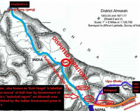
Limpidhura is considered the origin of Kali (Mahakali) river which demarcates the border between the two countries as mentioned in the Sugauli Treaty signed between the then East India Company and Nepal in 1815.
The Nepali civil society members came up with the new political map of Nepal, few weeks after India released a new political map placing Nepali territories Limpiadhura, Lipulekh and Kalapani inside Indian borders.

During the press conference, civil society members advised the government to strongly oppose the Indian political map that placed Nepali territories Limpiadhura, Lipulekh and Kalapani inside its borders.
Former secretary Dr Dwarikanath Dhungel said that the political map prepared by the civil society members will be handed to the Nepal government soon. "We want to take the new political map of Nepal to the United Nations as part of our campaign," he said.
Former Director General of Survey Department Punya Prasad Oli said that Mahakali river is Nepal's western border with India.
At a time of huge public uproar across the country after a political map of India released by the Indians included Nepali territories demarcated by the Mahakali River on Nepal’s western border, any mention of the river, which is known as Kali in India, is conspicuously absent in the ninth edition of the political map released by the Survey of India recently.
The Kali River mentioned in previous political maps released by India serves as Nepal’s natural border with India on the western frontier, as per the Sugauli Treaty reached between Nepal and the East-India Company in 1816. Nepal had to lose huge swathes of territory in the east, south and west under this treaty.
Although the Indian side did not mention the name of the river in its political maps after Indian troops were stationed on Nepali territory in Kalapani after the 1960s, the eighth edition of the Indian political map clearly mentioned the Kali River.
Although various treaties and historical evidence suggest that the origin of the Kali River is the holy Parbatikunda, the Indian side has been claiming otherwise. As per the position maintained by Nepal on the basis of these evidences, various villages including Nawi, Gunji and Gabryang fall on the Nepali side of the border—something India has been denying for long.
Survey Department officials in Nepal see the latest Indian move to avoid naming the river as meaningful as Nepal has been insisting that territories that lie on the eastern side of the river are Nepali territory as per the relevant treaty and agreements reached in the past.
You May Like This
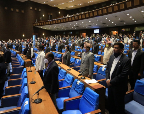
House of Representatives set to endorse constitution amendment bill today
KATHMANDU, June 13: The House of Representatives (HoR) is all set to endorse the constitution amendment bill today to pave... Read More...
Even India's official documents show that Limpiyadhura is the real source of the Kali River (with video)
KATHMANDU, May 22: War of words between Nepal and India has intensified after Nepal issued a new political map that... Read More...
Nepal govt is awaiting dates for holding talks with India on border issues : FM Gyawali
KATHMANDU, May 29: Minister for Foreign Affairs, Pradeep Kumar Gyawali has said that the Nepal government is awaiting dates for... Read More...
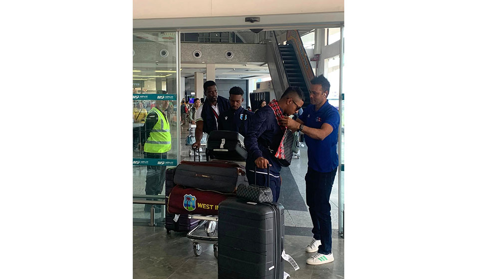
West Indies ‘A’ cricket team arrives in Nepal
22 hours ago
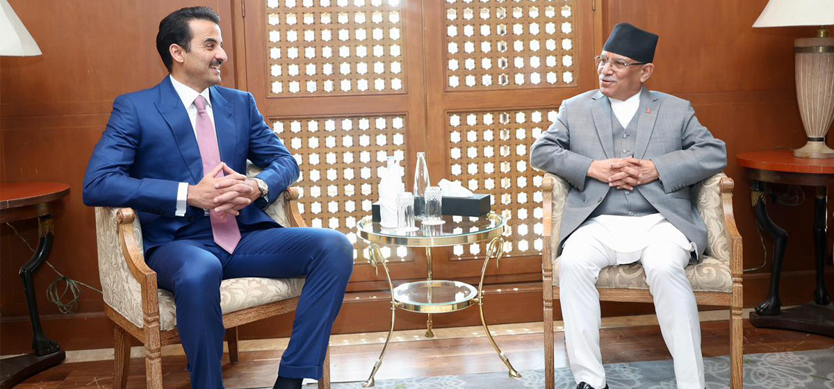
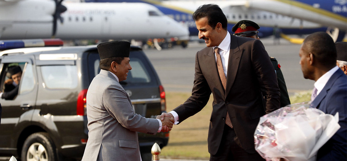
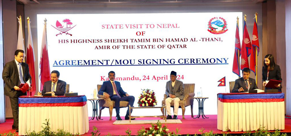
PM Dahal hosts luncheon in honor of Qatari Emir
22 hours ago


Bus knocks down a pilgrim to death in Chitwan
8 minutes ago

One killed in tractor-hit
29 minutes ago

Gold price decreases by Rs 200 per tola today
54 minutes ago
Just In
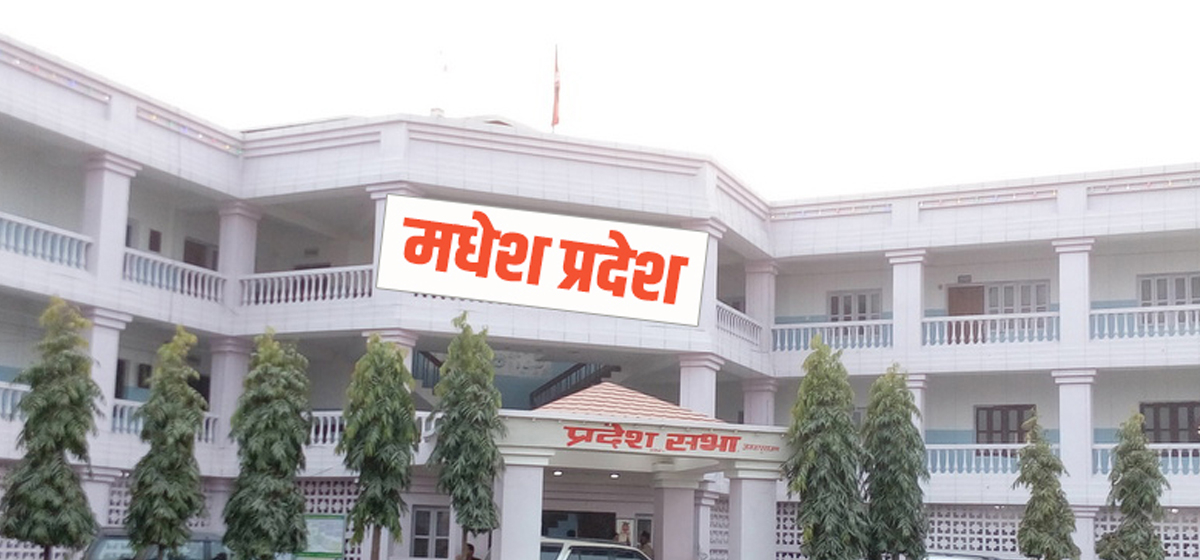
- Lungeli appointed as Minister for Labor and Transport in Madhesh province govt
- Bus knocks down a pilgrim to death in Chitwan
- One killed in tractor-hit
- Karnali Chief Minister Kandel to seek vote of confidence today
- Chain for Change organizes ‘Project Wings to Dreams’ orientation event for inclusive education
- Gold price decreases by Rs 200 per tola today
- National Development Council meeting underway
- Meeting of Industry, Commerce, Labor and Consumer Welfare Committee being held today
Leave A Comment