Friday, 19 April 2024 05:02 PM
OR
Login using
Nepal releases revised political map that incorporates Limpiyadhura, Lipu Lekh and Kalapani, the territories encroached by India
Published On: May 20, 2020 10:11 PM NPT By: Republica | @RepublicaNepal
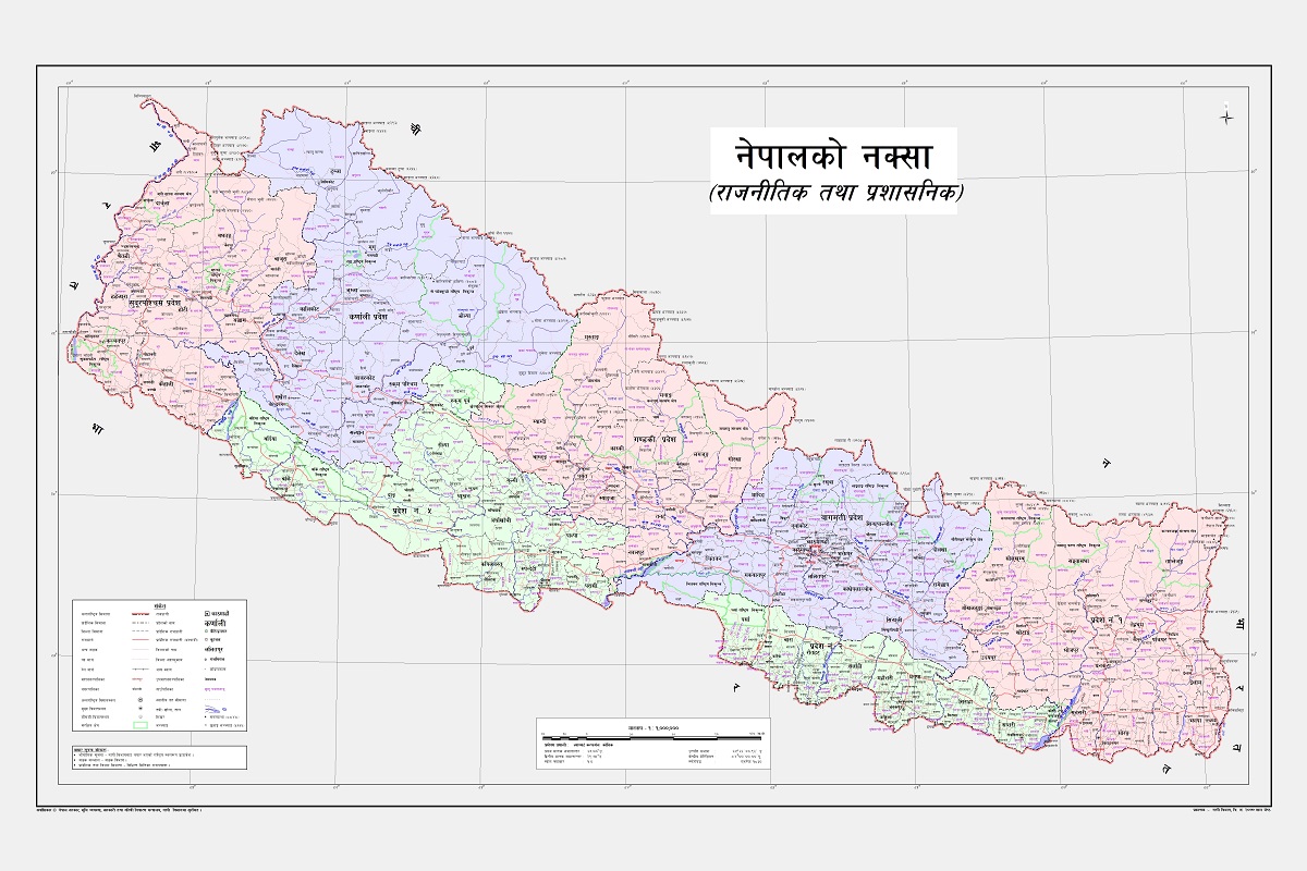
KATHMANDU, May 20: Nepal government has released the revised political and administrative map of Nepal that incorporates Limpiyadhura, Lipu Lekh and Kalapani, the territories encroached by India.
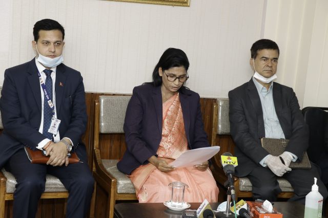
Amidst a televised press conference at the Ministry of Land Reforms and Management in Singha Durbar on Wednesday, Minister Padma Aryal unveiled the new political and administrative map of Nepal.
Earlier this week, the government had endorsed a new political map that includes Kalapani and Limpiyadhura territories of Nepal that are currently occupied by India. A cabinet meeting held at the official residence of the Prime Minister in Baluwatar on Monday had made the official decision in this regard.
The new map has been updated in the schedule of the constitution, coat of arms and school curriculum and will be kept at every government office. He also said that the new map will be tabled at parliament for constitution amendment.
The government, while presenting its annual plans and policies for the upcoming fiscal year 2020-21 on May 15, had committed to issue a new map of Nepal incorporating the encroached region of Kalapani, Lipu Lekh and Limpiyadhura.
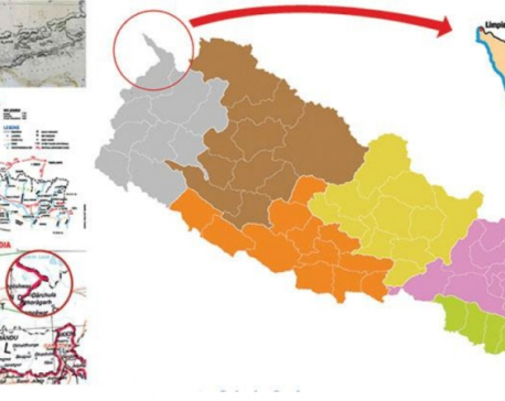
The new map has retrieved 335 sq km of encroached land. Gunji, Nabhi and Kuti villages have been included within the Nepali border. The present map in practice, issued in 2032BS, does not have 335 sq km of the Limpiyadhura region.
Earlier, the Department of Survey had prepared the map including those territories and submitted it to the Ministry of Land Management. Technicians at the Survey Department had prepared the map with accurate scale, projection and coordinate system. “This map has included all the Nepali territory as mentioned in the Sugali Treaty of 1816,” said a technician at the department.
The department had also provided factual evidence including a map drawn during the Treaty of Sugauli, another map brought from London, receipts of payment of land revenue and the order issued by the then Prime Minister Chandra Shumsher, to the ministry. One of the high-ranking officers at the department said, “Collecting proof is an important task, which we have successfully accomplished.”
The government had been under pressure to issue the new map by incorporating the territories encroached upon by India since the southern neighbor unveiled its new map placing Nepali territory of Kalapani inside Indian borders.
Indian home ministry released the political map placing the Nepali territory of Kalapani inside the Indian borders after creating Jammu and Kashmir and Ladakh as its union territories.
The State Affairs and Good Governance Committee under the House of Representatives had issued a written directive to the government on November 11 to issue a new map including the encroached territory. Another meeting of the committee in the Nepali month of Baishakh had also sent a directive to the government to publicize the new map claiming that the Limpiyadhura region is the source of the Mahakali River- the Nepal-India border as stated in the Sugauli Treaty.
According to the Department of Survey, the map of a country is prepared in two different ways - administrative map and boundary map. Boundary map is prepared after the administrative one is finalized, for which technicians have to make a field visit. The one endorsed by the cabinet is the administrative one.
Kalapani region extends over an area of 60 sq km. The territory including Limpiyadhura covers 335 sq km. It means a total of 395 sq km of land has been incorporated in Nepal's map which has been encroached by India for decades.
According to the secretary at the Ministry of Land Management, Kedar Neupane, the map was submitted to the ministry by the Survey Department and then tabled at the cabinet meeting by the ministry. The Minister for Land Management, Padma Aryal had presented a proposal of a new political map of the country at the cabinet meeting for endorsement.
A committee formed under the leadership of a former Chief Commissioner of the Commission for Investigation of Abuse of Authority had also submitted a report along with Nepal’s complete map some four years ago. The report had also claimed the Limpiyadhura region as the source of the Mahakali River.
You May Like This
Nepal govt is awaiting dates for holding talks with India on border issues : FM Gyawali
KATHMANDU, May 29: Minister for Foreign Affairs, Pradeep Kumar Gyawali has said that the Nepal government is awaiting dates for... Read More...
India asks Darchula administration to bar Nepalis from entering India-occupied Kalapani
KATHMANDU, July 27: India has asked Nepal's Darchula District Administration to bar the Nepali people from entering Gunji, Kalapani and... Read More...


_20240311121839.jpg)

Just In
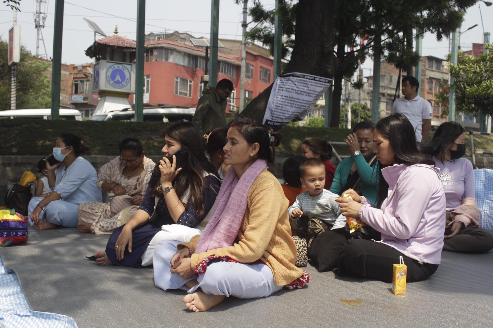
- In Pictures: Families of Nepalis in Russian Army begin hunger strike
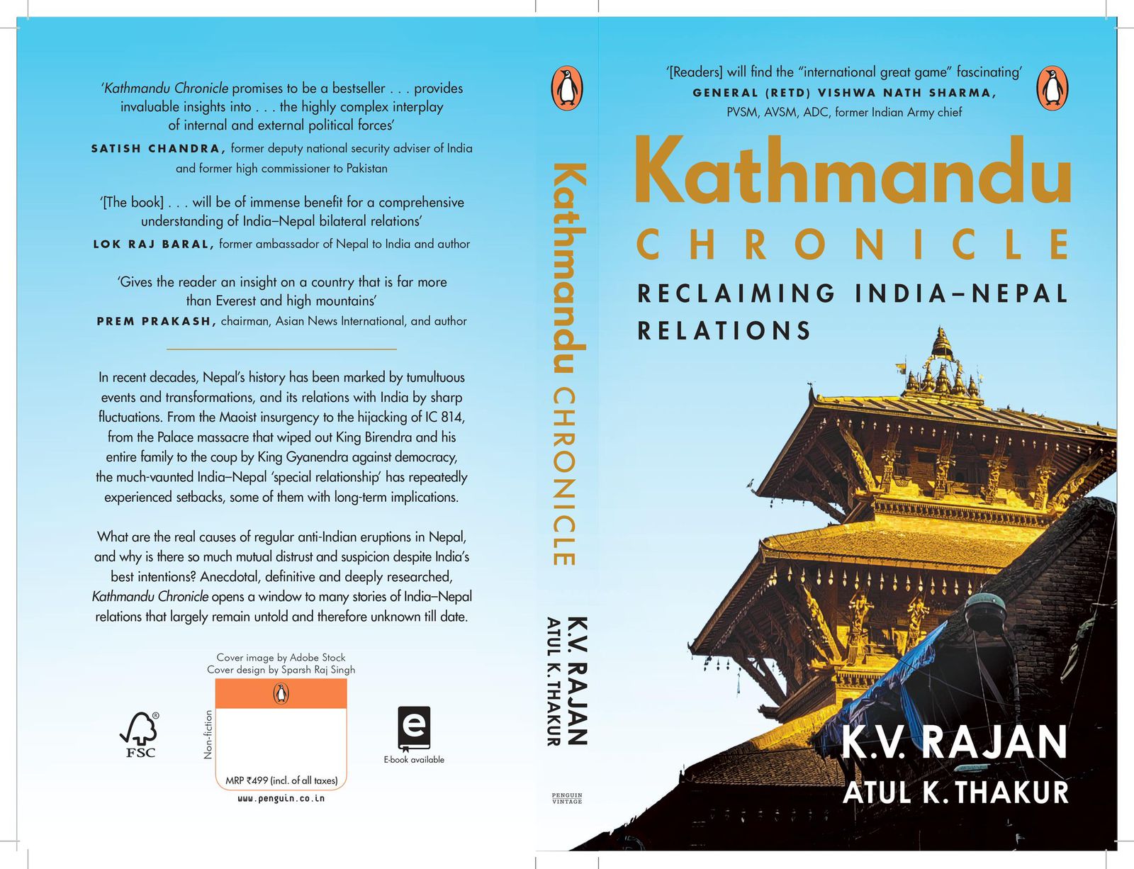
- New book by Ambassador K V Rajan and Atul K Thakur explores complexities of India-Nepal relations
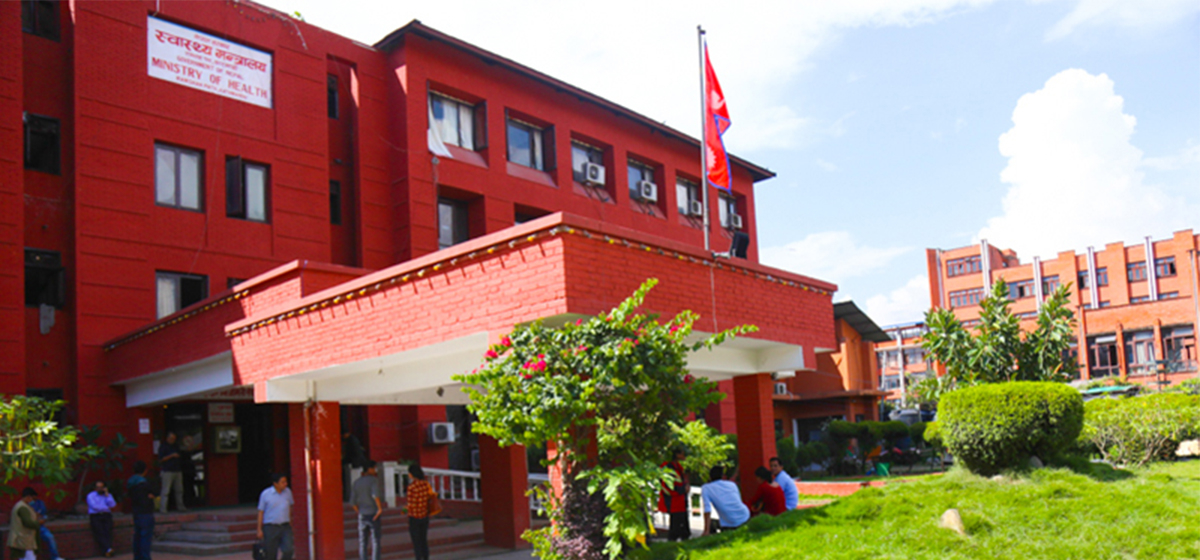
- Health ministry warns of taking action against individuals circulating misleading advertisements about health insurance
- UAE secures spot in ACC Premier Cup final, defeating Nepal by six wickets
- NC to boycott Gandaki Province Assembly, submits letter to Speaker
- 850 grams of gold seized from Indian national at TIA
- Rupandehi District Court orders to release Dipesh Pun on a bail of Rs 400,000
- Teachers’ union challenges Education Minister Shrestha's policy on political affiliation
Leave A Comment