Friday, 19 April 2024 11:23 PM
OR
Login using
THURSDAY TALK
With 20 percent weight for ‘geography’, all three regions would have benefitted
Published On: September 7, 2017 01:00 AM NPT By: Mahabir Paudyal | @mahabirpaudyal

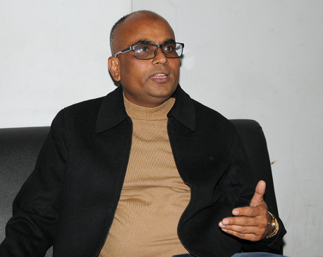
The Constituency Delimitation Commission (CDC) recently presented its final report to Prime Minister Sher Bahadur Deuba. While Madhes-based parties have criticized the report for under-representing Madhes, others argue that it does the opposite: over-represent Madhes and under-represent hills and mountains. What is the case? What is the international practice? Was the commission right in giving only 10 percent weight in electoral constituency delimitation to ‘geography’ while 90 percent weight was given to ‘population’? Professor of Geography at Tribhuvan University’s Central Department of Geography Bhim Prasad Subedi shared his thoughts with Republica’s Mahabir Paudyal.
What is your assessment of the recent report of the Constituency Delimitation Commission?
People have interpreted CDC’s report from various angles. If you make population the main basis, you will reach one conclusion. If you take geography into account, you will present a different picture. As a student of geography, I would say the report is unfair to our hill and mountain regions.
Constituency delineation should have been carried out with great care as we are not going to delineate electoral constituencies for another 20 years. But the CDC report seems to take into account only the upcoming provincial and federal elections. It should have been more far-sighted.
Are you suggesting that 20 years is a long time to redraw electoral boundaries?
The rules for revising constituencies are country-specific. In India, for example, constituencies delineated in 1971 will be revised only in 2026. Elsewhere, constituencies are revised every 10 years because census is carried out on a decennial basis. Ten years is an epoch in politics. Important things like population, resources and development index can change in 10 years. But this is not what bothers me, it is something else.
Over the past few years, our population pattern has changed. We have shifting populations. Until a decade or two ago, there was a trend of migrating down to the plains from the hills and mountains. But migration was different in different regions. In eastern Nepal, for example, there was a lot of hill-to-plain migration during the 1980s and the 1990s. In western and far-western parts, this kind of migration sped up only in the past one decade. This is one region for population explosions in Kailali and Kanchanpur districts. In the eastern parts, many people have stopped migrating down to the south, and many have now permanently settled up in the hills. They may descend to the Tarai, buy a piece of land and build houses but, unlike in the past, they do not severe their ties with the hills.
Today we talk of ‘bi-locality’ and ‘multi-locality’. Ask someone where they come from, and they will tell you that despite living in Kathmandu for generations, they belong to a hill area in the east or the west. This applies to those migrating to Kathmandu from Madhes as well. A Madhesi who has migrated to Kathmandu and lived here for generations will tell you that he actually hails from Saptari or Siraha.
There are people who first migrated to the plains from the hills and then moved to Kathmandu. This group will have attachment not only with the plains they left behind but also with the hills which they left much earlier. They still hope to get back to those places of their origin. This is how we are creating bi-locality and multi-locality. In the next 10 years, we will have a completely different picture. Members of the commission should have taken this reality into account.
But that is easier said than done, especially since members of the commission were under strict time pressure.
I understand that it is easier said than done. I am telling you this because the current boundaries will stay for 20 years. If you look at 2011 census, hill-to-plain migration has drastically decreased, compared to a decade earlier. The only exception is the far-west. So we should have considered all these aspects, as far as possible. Political leaders and even members of CDC at times seem to have worked with faulty notions of geography.
What are those faulty notions you allude to?
There are three understandings of geography. One is a layman’s understanding based on map, rivers, hills and general knowledge. The other is what we teach in classrooms. This includes human geography, physical geography and regional geography. Political leaders here have considered only physical geography and focused only on boundaries, landmass and areas. But our concept of geography encompasses both the place and the people.
Geography is the interaction and interrelation between the two. It includes economic interrelation between two regions. Thus, in a way, eastern hills and eastern plains become one geographic unit as they are economically interrelated. It would not be appropriate to demarcate parts of eastern region as hills and remaining parts as Tarai as their people, geography and society are interconnected. You cannot limit a person to a fixed geography. But this aspect of geography was overlooked while demarcating electoral constituencies.
The constitution says electoral constituencies will be demarcated based on ‘population’ and ‘geography’. It does not specify the weights that are to be ascribed to these two factors. The CDC gave only 10 percent weight to geography, while 90 percent weight was given to population. Was this a fair assessment?
If you look at the international practice, normally, electoral constituencies are not drawn based only on geography and population. Rather five general principles are followed in doing so: impartiality, transparency, non-discrimination, representativeness and equality. The most important is impartiality. That means the authority that determines electoral constituencies must be impartial first. This is where we failed. The officials inducted into CDC were biased towards the political parties that nominated them.
The second mistake they made was that they focused only on number of people, not their distribution. As a result, hills and mountains lost seats. Most hill districts lost one seat each.
What in your view would have been a fair breakdown of the percentages of population and geography?
If only we had given 20 percent weight to geography, all the regions would have benefitted. The mountains would get 20 seats, the hills 71 seats, and the Tarai 74 seats. The Tarai would have gotten four fewer seats than has been currently allocated to them but the Himalayas would not have lost their representation either.
Nepal’s mountains have lost the most in current demarcations. But if Parsa, Siraha and Saptari agreed to concede one constituency each, there would be perfect equilibrium. Current scheme has completely undermined issues of accessibility and convenience. A single elected leader will have to represent vast hill districts like Ramechhap and Dolakha. It would take him three or even five days to reach some people in his constituency. This may sound biased but as a geographer I believe the hills and the mountains together should have had greater representation than the plains.
Why do you say that?
It is difficult to comment on the CDC report because it has been given a sacrosanct status, where it cannot even be questioned in a court of law. This should not have been the case. Yes, I understand that time was of the essence and it was a complicated task. But that is no reason to bar public debate on the issue. If the CDC was represented by Nepal’s top geographer, say like late Harka Gurung or a top sociologist like Chaitanya Mishra or the widely-admired administrators, it would have been a different matter.
But, frankly, the members of CDC were appointed based on political bhagbanda and each member put his party first. Perhaps one of them made 32 constituencies for Province 2 his bottom-line. Other may have made similar recommendations for other provinces. I mean that committee members came with preconceived notions on the number of electoral constituencies. So you have two Rukums today.
They cited the past precedent of allocating 116 seats for Madhes, when we had 240 constituencies in all. They said nothing less than 116 will be acceptable for Madhes this time. The Madhesi parties started citing Girija Prasad Koirala, who had in 2008 allocated constituencies in the plains based only on population. This was one of his biggest mistakes. When 116 seats were given to Tarai, the hills had to compromise in the interest of the high mountains. Our constitution said population and geography will be the basis for creating constituencies. But since this geography was not defined, our leaders did pretty much as they pleased.
What will be long term consequences of having fewer constituencies in the hills and the mountains?
Like I said, a wrong notion has been created that representation means people, and only people. But in the days ahead resources of the hills and the mountains are going to be very important. These two regions command large share in tourism industry, water, forests, minerals and medicinal herbs. Now there will be very few representatives to ensure proper utilization of these resources. A single representative won’t be able to reach every village and town in the district. People won’t be able to interact with him because he will be scarcely available. Thus this will delay our process of attaining prosperity. We should not limit hills and mountains to their population alone. Can you dismiss the importance of Mt Everest by saying that there is no human settlement in higher reaches of Solukhumbu region? We need access to resources of the hills and mountains. We need enough representation for this.
The CDC was asked to consider population as the major basis while delimiting constituencies. It took into account 2011 census data, which puts Nepal’s total population at 26 million. This data does not include around two million ‘absent’ population, and 53 percent of these absent people are from hills and mountains. They are the ones sustaining our economy and livelihood by working hard in foreign lands. They are genuine citizens who will return one day. How could CDC exclude this important population?
In your view, does the current demarcation of federal provinces do justice to geographical considerations?
We have created mixed kind of provinces. In Province 1, Province 7 and Province 5, for example, they have taken into account economic and social interaction of the hills and the plains. The idea of resource complementarity reflects in these provinces. But this is not the case with Province 2, which has been isolated from the hills. A province won’t be able to sustain itself unless it is supported by natural resources, many of which lie in the Chure range and the hills. There is where you have mines, stones, water and forests. Province 2 has been kept away from these vital resources. Again, as a student of geography, I may be biased towards geographical factors, but I cannot also overlook the fact that our most economically viable provinces will be those stretching from north to south. In fact, our social and economic life is based on north-south orientation.
Like I said earlier, today we have entered a phase of multi-locality. Unlike the past, people in the mid-hills do not descend to the Tarai plains. There is not only north-south but also south-north cross-flow today. With better road networks this will be more common in the days ahead. We do not live in the hills but we have our lands, properties and relatives there. Around six percent of Kathmandu’s population is comprised of Madhesis. They interact with both Madhes and Kathmandu. Chhath is celebrated in Kathmandu with equal enthusiasm. This is how we are creating multiple localities. So you cannot limit Madhesis to Province 2.
We are guided by the wrong notion that everything done in the past was wrong and need to be dismantled. In the process, we separated hills from the plains. Many advocate for deconstruction of the concept of districts today but then these districts have been taken as the main basis while delineating electoral constituencies. This shows how relevant the idea still is. The districts we have today will be used as connecting points to interact with people. The mess we are witnessing in province demarcation and constituency delineation has its roots in destruction of all old infrastructures without creating new ones to replace them. We seem to be moving four steps forward but we are actually moving three steps back. We decried the ‘five development regions’ as the relics of monarchy and yet we made them the major basis for province creation. Again, breaking down everything that was done in the past is no solution.
You May Like This
"It is wrong to say we have no money for federal infrastructures. We have plenty"
Financial viability of the federal model has been a big concern of Nepali policymakers and economists in recent times. Many... Read More...

If not 'Gangster', Kangana would have done an adult film
MUMBAI, Dec 31: National Award-winning actress Kangana Ranaut, who made her debut in Bollywood with 2006 romantic crime drama film... Read More...
‘To what regions have joy emanating from my resignation spread?’
KATHMANDU, July 27: "To what regions has the joy emanating from my resignation spread?" Is it within the country or... Read More...

ACC Premier Cup semi-final: Nepal vs UAE
12 hours ago

Rain shocks: On the monsoon in 2024
15 hours ago

_20220508065243.jpg)


Just In
- MoHP cautions docs working in govt hospitals not to work in private ones
- Over 400,000 tourists visited Mustang by road last year
- 19 hydropower projects to be showcased at investment summit
- Global oil and gold prices surge as Israel retaliates against Iran
- Sajha Yatayat cancels CEO appointment process for lack of candidates
- Govt padlocks Nepal Scouts’ property illegally occupied by NC lawmaker Deepak Khadka
- FWEAN meets with President Paudel to solicit support for women entrepreneurship
- Koshi provincial assembly passes resolution motion calling for special session by majority votes
Leave A Comment